Geology
 North View of Seal Rock's "Giant's Causeway" (c. 1950) courtesy Oregon State Archives
click to enlarge
North View of Seal Rock's "Giant's Causeway" (c. 1950) courtesy Oregon State Archives
click to enlarge
North View of Seal Rock's "Giant's Causeway" (c. 1950) courtesy Oregon State Archives
|
SEAL ROCK's geology has a long and interesting history.
This natural area was formed when the uppermost part of the mantle partially melted and magmas rose
through the crust to the surface about
14 million years ago.
(1)
At that time, the coastline was about 100 miles inland when a fissure erupted causing the Earth's crust
to break apart, sending fountains of lava hundreds of feet high. It then crept slowly across the landscape
making its way to the sea.
(2) The resulting geologic fault lines are still visible at Seal Rock State Park.
More recent geological studies found that profound seismic activity occurred on 26 January 1700,
when an estimated 9.0 earthquake rocked the Pacific west coast sending a tsunami from the Washington-Oregon
coast to the coast of Japan. This was confirmed by Japanese writings that recorded the time, date,
location and effects of that catastrophic event.
At the SEAL ROCK viewpoint, the largest formation resulting from this landscape transformation is a sea stack
supported by sandstone, which rises boldly above the horizon and is known locally as "Elephant Rock".
 "Elephant Rock" at Seal Rock by B. Goody
click to enlarge
"Elephant Rock" at Seal Rock by B. Goody
click to enlarge
"Elephant Rock" at Seal Rock by B. Goody
|
This giant sentinel acts as a habitat and nesting ground for several sea bird species including
brown pelicans, gannets, gulls and cormorants.
Elephant Rock also serves as a kind of
way point or resting area for weary
birds migrating along the coast. Resident Bald Eagles have also been
seen enjoying a view from atop this massive bird refuge.
Along either side of this mammoth formation, you will find a series of dark colored igneous rocks
that rise to about 20 feet from the sea surface. Waves crashing against them create a spectacular
symphony for the senses any time of the year, but especially during the Pacific winter storms!
Almost daily you will find storm watchers lined along the roadside with binoculars fixed upon
the explosive scenes that can only be experienced to be truly appreciated.

 Seal Rock Goliaths by B. Goody
Although Seal Rock viewpoint is a palpable gem, there also exists a hidden
natural treasure trove where visitors may, during a low tide, find a ledge of rocks covered
in a thick coat of bright green seaweed. These rocks are usually submerged in the Pacific Ocean
along the tidal surf line and extend parallel to the coast for about two and a half miles
and are found a distance of a half mile from the shoreline.
(3) Sheltered within
this protected cove is one of the largest collections of coastal tide pools teeming with a
colorful variety of marine animals.


 Seal Rock Tide Pools by B. Goody
Primary access to these natural wonders is through the
Seal Rock State Park
recreation site with some access from the south across from the Seal Rocks RV Park. Access to offshore rocks is prohibited
as they are part of the Oregon Islands National Wildlife Refuge. Even rocks that are accessible at extreme low tides
may be included in this designation. If the rocks are
not connected to the land at high tide, they are considered
to be a part of the refuge.
SEAL ROCK is also the home of an access-restricted archeological site located in the vicinity that is listed on the
National Register of Historic Places.
(4) To protect its artifacts and ensure historical preservation,
the exact location is not disclosed to the public.
Other artifacts and fossils have been discovered just to the north of the entrance to Seal Rock State Park across
from Grebe Street, which conceals a small path leading down to the beach. Fossils are said to be found when
a low tide exposes Nye Mudstone and Astoria Formation Sandstone which appears below bluffs found north of the Seal Rock
village. You'll find this location near a small parking lot with a rocky path taking you to the beach. Treasure hunters
say to head north during a low tide.
The tide pools and shorelines of SEAL ROCK may also reveal agates that are tossed up onto the beach during heavy surf.
Agates can be many colors, but SEAL ROCK's agates look almost transparent when lying in a tide pool and have an
opulent blue tone when dry.
 Ancient Middens by B. Goody
Ancient Middens by B. Goody
|
Remnants of long ago Indian tribes were still evident, even after the U.S. government began to open up
settlement of their lands to white landowners in
the 1800's. SEAL ROCK land owners of the day may have found shell beds that would range in
depth from one to six feet indicating several generations of tribal settlements existed at SEAL ROCK during ancient times.
Some evidence of Indian shell middens (mounds) still remain along the roadsides as the SEAL Rock viewpoint.
The ancient mounds are believed to be between 300-1800 years old - the oldest being at the bottom of the mound.
Continue your history lesson with Seal Rock's
Early History
Credits and Contributions:
1) http://dusk.geo.orst.edu/oceans/OC103FieldTrip.pdf Retrieved on 02.02.08
2) http://www.beachconnection.net/news/geo14046_2233.htm (By André Hagestedt) Retrieved 02.08.08
3) http://www.oregoncoast.history.museum/Communities.htm - Retrieved on 02.08.08
4) National Register of Historic Places
Remainder of content (c) B. Goody 2007-2009 - All Rights Reserved
Our special thanks to the Lincoln County and Waldport Historical Societies
for their contributions of photographs and information.
All Photographs are copyrighted and remain the property
of the original named photographer with all rights reserved.
Using any of these photographs without express permission
by the owner is considered copyright infringement.
If you would like to contribute photos or information to the SEAL ROCK HISTORY project,
please
e-mail the webmaster today!
Updates, corrections and new pictures are always appreciated.
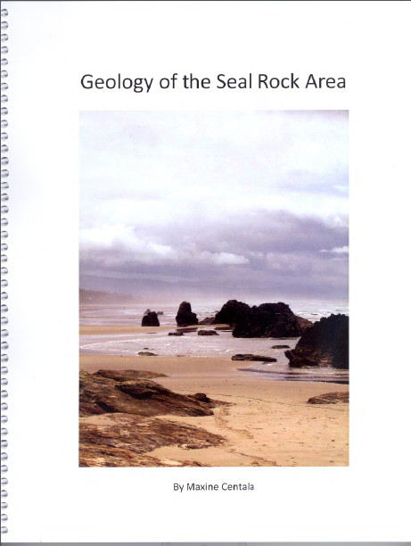 Geology of the Seal Rock Area
 was written by local resident Maxine Centala
This spiralbound book is 8.5 x 11 inches, 94 pages, with over 100 COLOR photographs. Truly an exquisite book. There are also several photo gallery sections in the book.
The publication covers many aspects of the basalt, sandstone and sea cliffs that are visible along the beach between Alsea Bay and Ona Beach State Park. It also includes a section on Yachats Basalt, and briefly mentions the basalts of Yaquina Head, Cape Foulweather and Depoe Bay. It was written by a local resident, Maxine Centala of Seal Rock, who had wished for better nontechnical information about local landforms, and decided to fill that gap. It covers topics such as sedimentary rock, basalt, paleontology, buried forests, marine terraces, changing sea levels and earthquakes.
The text is accompanied by over 100 photographs, maps, diagrams and a list of references, all designed to help local residents and interested visitors learn about the rocks and landforms found here and how they came to be.
A complete PDF of the book is available at
geologyofsealrock.wordpress.com.
